D
Wildlife Monitoring
Along with the restoration projects we perform, we realize how important environmental monitoring is and make sure to make it a large part of our work. We complete water quality, wildlife, project and other environmental monitoring. Monitoring allows us to understand whats going on around our watershed, and to make sure our projects play out as we want.
Water Quality
Water quality assessments are done monthly at multiple sites around the watershed. Our HOBO Depth Logger and YSI sites include Campbells, Hopedale, Johnsons, MacLeod, Rosewood and Route 13. YSI only sites include St.Patrick’s Road, Bagnall’s Culvert, Moffats, Farmhouse Inlet, Line Road, and Route 6. We also have HOBO loggers at each depth logger site that collect temperature, depth, and pressure data every 15 minutes. These loggers can hold large amounts of data internally and are then taken out of the streams 2-3 times a year to download and analyze the data. Along with the depth logger data, we take flow and depth data from 10 points along the cross-section of the stream using a meter stick and a flow meter. We also take water samples at all our depth logger sites. The water samples are analyzed by the PEI Analytical Laboratory for increased accuracy.

Redd Surveys
Brook trout migrate further up our streams to spawn in late fall, typically between the end of October and into the beginning of December.
During redd surveys, we walk along many of the tributaries within the Hunter - Clyde Watershed to look for redds. Redds are the “nests” that brook trout make to lay their eggs in. We complete redd surveys to get a better understanding of the reproduction that is occurring within our streams, and to note which areas are more or less productive. We take a GPS point of each redd, along with notes and photos.
How are redds made? First, the fish will lay on their side and dig a hole with their tail. Next, they will lay their eggs in the hole and fertilization takes place. Lastly, the fish will flick small pieces of gravel over the eggs. Redds can be observed by the hole where the excavation took place and the mound of gravel that was used to bury the eggs. The gravel and silt will also be disturbed and slightly lighter in colour (as seen in the picture below)


A photo of a redd
Two brook trout on top of a redd

Two brook trout near a redd

Brook trout redd diagram
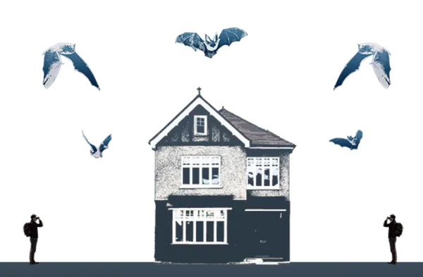
Bat Monitoring
1.Stationary Acoustic Recorder - Acoustic recorders are used to take recordings of bat echolocation calls. The echolocation calls are at a frequency that humans can’t hear, which is why this special equipment must be used. The recordings are then analyzed and they can give us valuable information about t species presence and behavior. Hunter - Clyde Watershed Group performs bat monitoring surveys every summer. Pictured are stationary recorders that we put at three different locations around our watershed. We then send the recorders back to the PEI Watershed Alliance, where the data gets analyzed.


2. Mobile transect - Mobile transect bat surveys are done by putting a microphone on the top of a car. As the car drives, the microphone will pick up on calls that the bats make. The car is set to drive along a certain route, while consistently driving 32 km/h. The survey should take place an hour to an hour and fifteen minutes after the sun sets. The data collected by the mobile transect can then determine the approximate abundance of bats along the selected route.
3. External roost counts - External roost counts, also known as emergent surveys, are conducted by sitting outside of a particular roosting site and counting the bats that exit the roost. This determines the approximate number of bats in that particular roost. The surveyors begin watching the roost 15 minutes before sunset and continue an hour after sunset if no bats are seen leaving the roost. If bats were present, you can end the survey when no bats have been seen leaving the roost for 10 minutes.
The ideal conditions for emergent surveys include no rain, wind less than 10km/h and temperatures above 10 degrees Celsius. The Hunter Clyde Watershed Group has conducted roost counts at three locations so far this season.
Moth Surveys
Moths help pollinate native and ornamental flowers, crops and other plants. They are also a really important part of the food web. We monitor them by setting up a sheet in the woods, we then project light onto the sheet which attracts the moths. We take photos of each moth and then ID them after the survey is complete. This gives us data on what types of moths are present around the watershed.


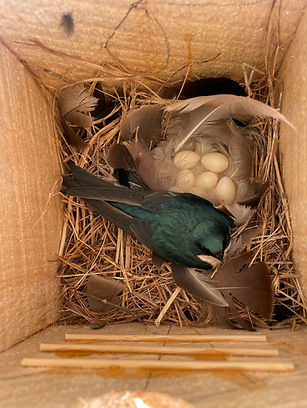
The Cross-Watershed Tree Swallow Box Program
“The Cross-Watershed Tree Swallow Box Program is a partnership between Trout River Environmental Committee, South Shore Watershed Association, Wheatley River Improvement Group, Kensington North Watersheds Association and Hunter-Clyde Watershed Group. This program aims to establish a standardized tree swallow monitoring program across the Queens County region with the intention of banding tree swallows and monitoring nesting success.” Hunter - Clyde built and installed 10 nest boxes, monitored these boxes three days a week, and banded one adult and 6 chicks between our two sites in the Summer of 2024. We are excited to be a part of the banding program again this coming 2025 field season.